

Part ten, Magical Geiranger from 0 M.A.S.l to 1500 and snow! Put kayka Geiranger on your to do list!
- Joachim Larssen
- 1. juli 2019
- 5 min lesing
Oppdatert: 6. mars 2020
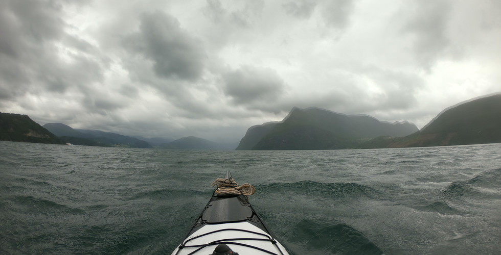
Day45, I wake up early and in the kayak before the tides tunes so i have the tides taking me inn to Storfjorden and after three hours I’m inn where the fjord starts and it’s an amazing sight long tall mountain going straight down to the deep waters. It’s a little windy and rain comes and goes. On my way I witness a rescue chopper saving someone from a hillside. It’s not many places to go inn here so I just keep kayaking until I get to Stranda just as the tides turns at 4pm, the view here has only get better and better for every mile! My plan is to rest for ether six or 18 hours so I get the tide with me, I start out with some food and charging before I kayak my way around the corner where there is a guest port where I place the kayak for the night and set up my camp behind some old boat houses.
Distance for the day 22,2 nautical miles, trash in water x0 and on land x0


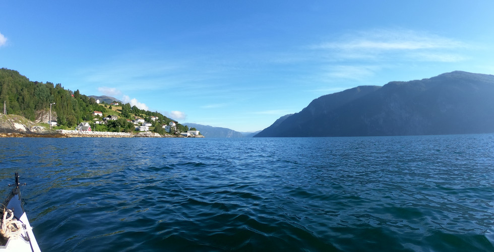
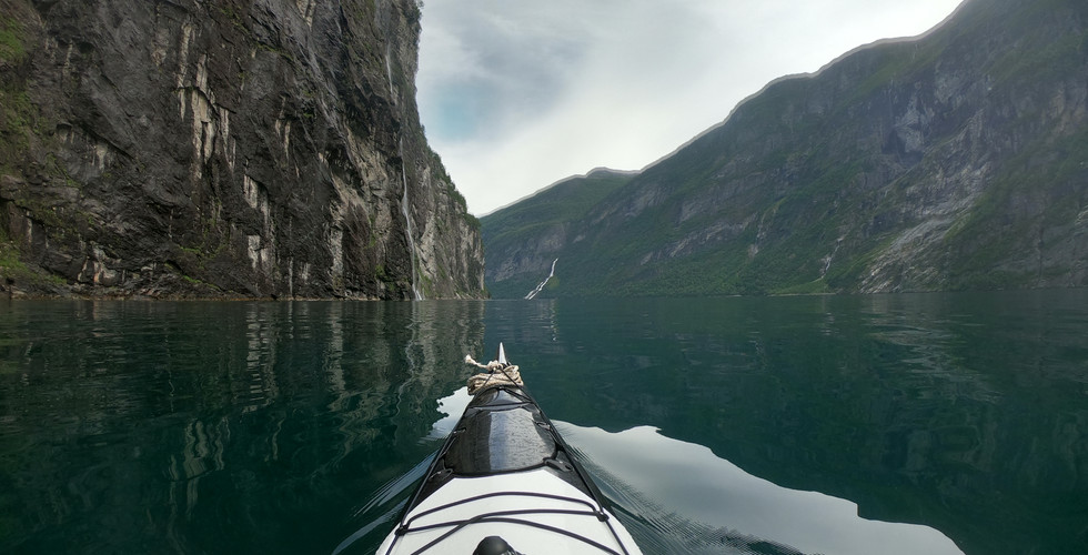
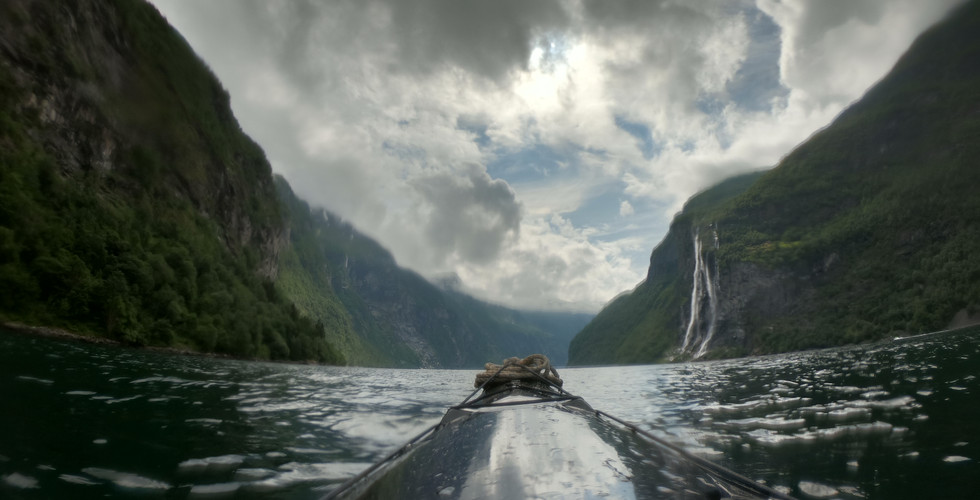
Day46. My body is not ready for kayaking in the night but at 07am I’m awake and full of energy and when I look out at the blue sky and sun shining on the fjords it’s an amazing scenery! I pack down, have my oats and at 8am I’m on my way. I have the tides against me until 10 but I don’t notes that much of a difference. I keep on kayaking trough Storfjorden stopping to record and take photos all the time. So many waterfalls and against all advice I have to kayak under one of them and I do get a little closer than recommended (20m minimum) but I don’t believe the Goods sent me all this way just to see me crushed by a bolder. After four hours of kayaking in Storfjorden I finally reach the last part of the fjord, Geiranger! Geiranger is one of the most visited fjords of Norway. The fjord in 15km long and 258m deep (Storfjorden is almost 700m at the deepest) with high mountain grope surrounding the fjords and at the highest they reach 1700m! No wonder it has made it on the
World Heritage list. And at 2.30pm I finally reach the end of the fjord and the camping site where I meet up with my old friend Sandra set up camp enjoy the beautiful sunset and catch up on our adventures with a beer before we find our tents for the night! Zzzzzzzz......
Distance for the day 21,9 nautical miles, trash in water x1 and on land x2


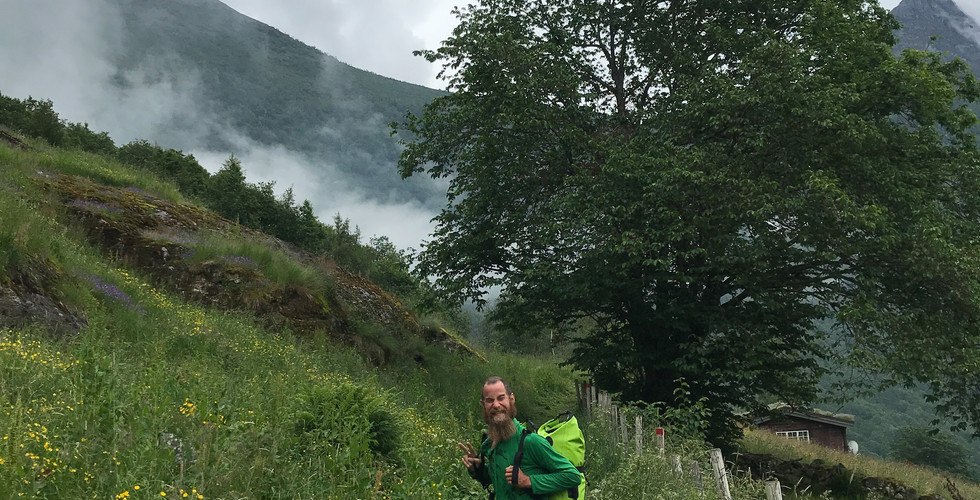
Day47 is a resting day for me and we sleep until mid-day before we bother getting out of the tent. I get some sweets and fruits for breakfast and then we pack down camp and start walking up to
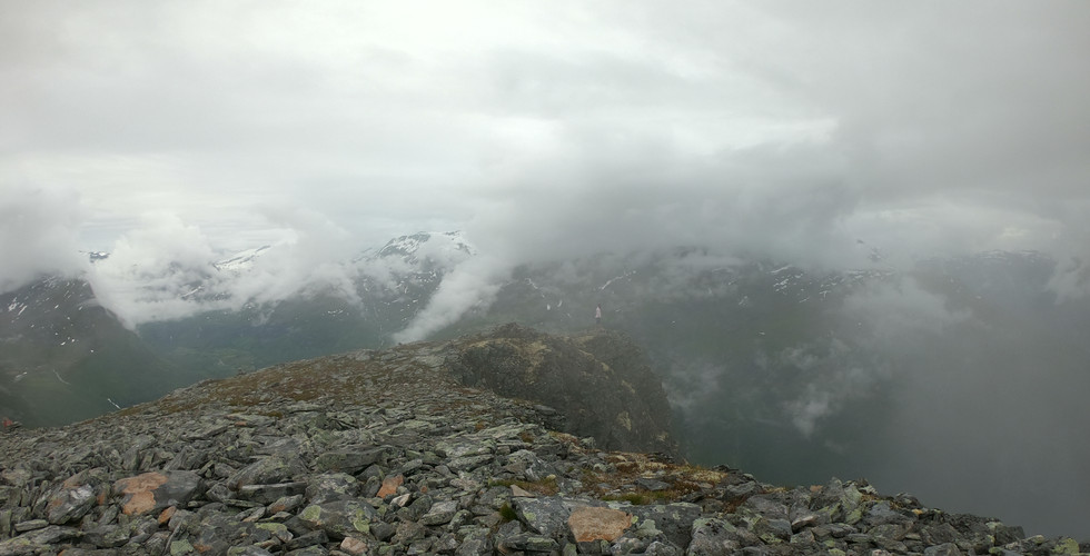
where Sandra works for the session it’s an hour’s walk up 300m above sea level, the track up is being made by shepherds from Nepal. When we finally get there we are meet by alpaca’s, goats and a beautiful old farm, it’s really charming! After Sandra has prepared todays dinner we head out for a hike! Today’s hike takes us up 1500m to
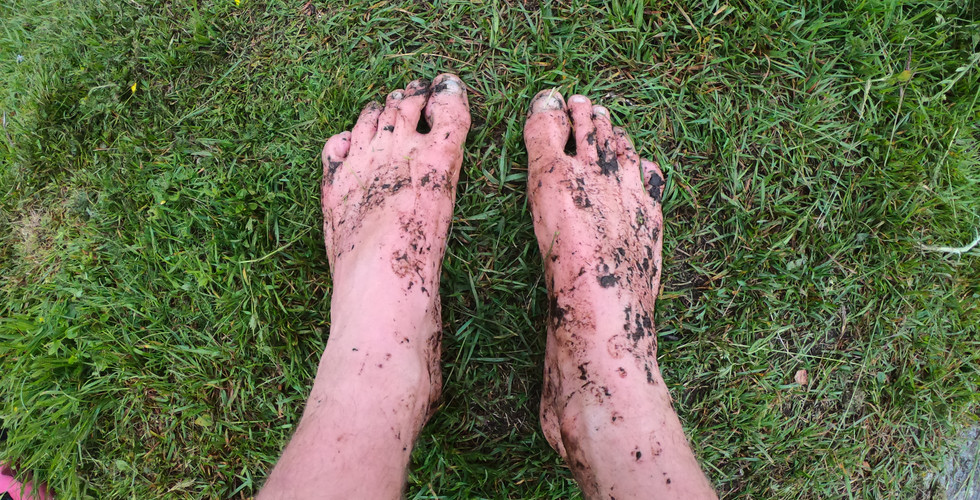
and on the way we find powerful waterfalls and steep tracks, we leave out equipment by the crossing to Westeraas seter and keep going up, up and up! Almost at the top we have snow that still haven’t melted and I’m tracking bare foot!
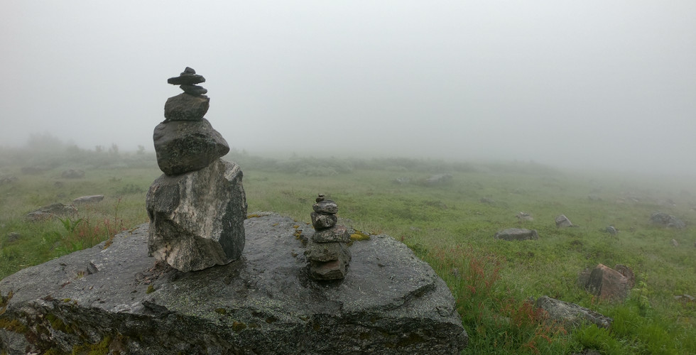
So I go to a warm place in my mind and then I run over the first stretch of snow, let my feet warm up a little and then the next and next….. We can finally see the top and there is no more snow at the last part. Finally we are there and I take a piss of the edge of the cliff and 1500m down I can see where I came in with my kayak a day ago. And after some photos and taking in the view we head back down the mountain again and find out equipment just where we left it and follow the track to Westeraas seter where we set up camp for the night and make a green curry dish before we say good night and go to sleep for the night with a thick fog sounding us in the valley.
Distance for the day 0 nautical miles, trash in water x0 and on land x1


Day48 Next morning we pack down camp and head back in the thick fog and when we are back at the farm I get a shower and oats before we head down to the restaurant where Sandra works for some waffles before we say goodbye and I head down the track to the start of the fjord. On my way down I find some ripe wild strawberries and gather them on a straw for a snack on my way down. A little past 3pm I’m back in my kayak on my way out of Geirangerfjorden and its nice and calm waters all the way until I get to Storfjorden here I am meet with a wall of winds and waves that are braking over me and the kayak so I get in to a pier and tie up my kayak with all the rope I can find and find shelter behind a boat house for the night.
Distance for the day 8,8 nautical miles, trash in water x0 and on land x0


Day49 is much calmer and I get going before 6am and I keep going nonstop for three hours until I take a brake at Stranda, shop for some wool underwear at Intersport and after tow hours I’m back in the fjord and its smooth kayaking until I get out of the fjord but here I get the wind and rain against me at the same time as the tides turns so it’s a hard crossing over to Skodje where I find shelter from the wind and a nice place to camp for the night.
Distance for the day 27,8 nautical miles, trash in water x1 and on land x0
If you want to kayak Geiranger it can easily be done in a day, it’s just 15km long but when I go back I want to rent a kayak go out to Storfjorden, then Strand and in one of the other arms of the fjord all the way into Tafjord and back again. I would set of one week to do this and spend what time I have left hiking!


Thank you so much
for inviting me to Geiranger and for going hiking with me! It’s been the best pit stop so far! And here are some extra photos from Sandra!


It’s not about getting to grense Jacobs elv it’s about kayaking Norway!
And I can’t give this kayak
enough credit! It’s amazing!

See where I am on
Thank you for reading!
Lots of Love
Joachim the ShibbyTraveler


Kommentarer